Riverside and Water Trails
When it comes to trails, we have two kinds: riverside trails and water trails. Riverside trails are those paths near the river that you can walk on. Water trails are mapped stretches of river you can access with watercrafts.
What is a Water Trail?
A water trail, or blue way, is a stretch of river that has been mapped out with the intent to create an educational, scenic, and challenging experience for recreational canoers and kayakers. They allow access to waterways for non-motorized boats and sometimes motorized vessels, inner tubes, and other craft. Water trails often connect users with additional amenities ashore, such as camping, wildlife viewing, and other facilities for boaters.
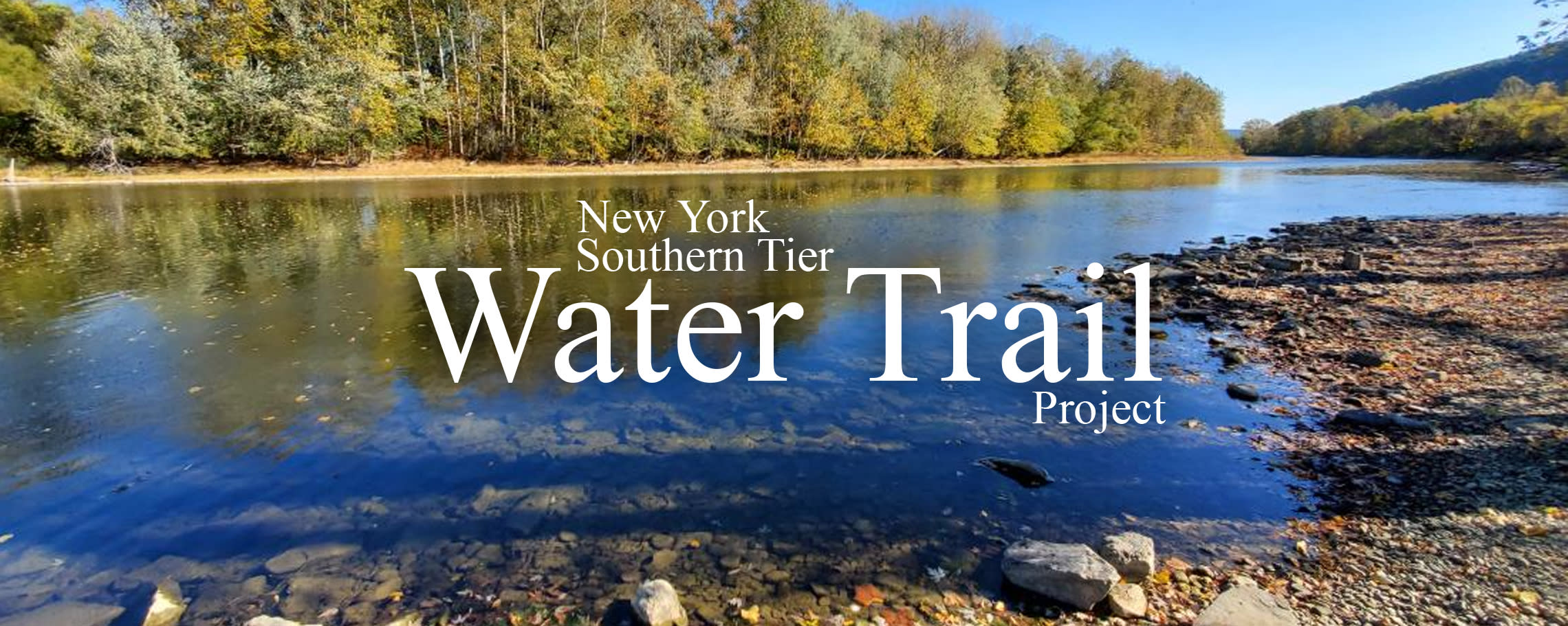
New York's Southern Tier Water Trail is a conceptual project intent on connecting outdoor recreation enthusiasts with water access in New York’s Southern Tier. The Chemung and Susquehanna river basins comprise over 190 miles of navigable waters, when combined with their tributaries, total well over 400 miles of potential water trail access. Combine that with access to the southern tips of three finger lakes and several smaller lakes and canals systems and the region has the makings of a world-class water trail system.
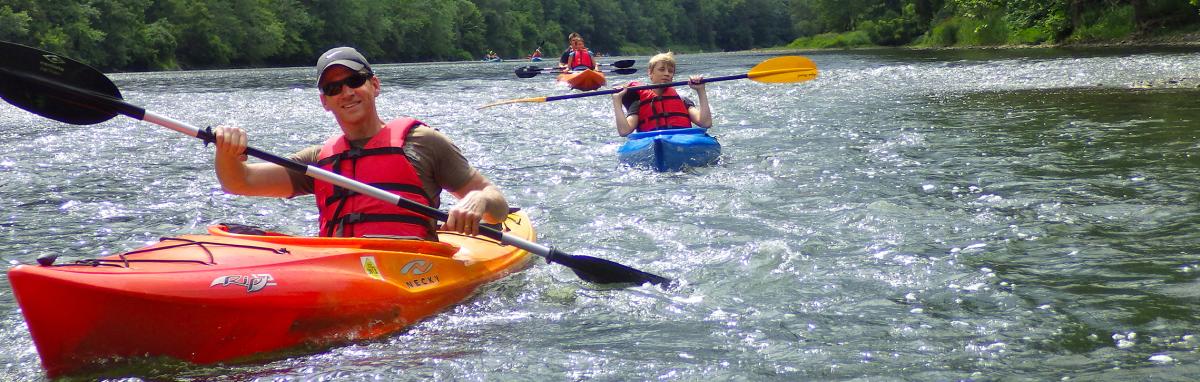 Credit: Southern Tier Kayak Tours
Water Trail Vision
Create a water-based trail system that will provide opportunities for recreation, conservation, tourism, and education while preserving the natural, historic, and cultural resources along the river.
- New major tourism product development
- Entrepreneurial business growth (e.g. outfitter business challenge)
- Downtown revitalization
- Tool for recruiting new people to visit, live, and work in region
- Vertical business opportunities (e.g. kayak manufacturing)
River Access
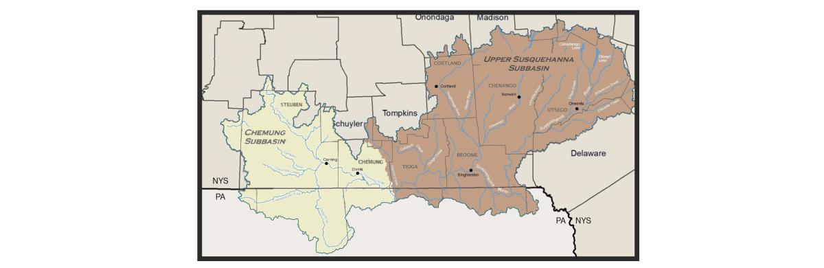
The Susquehanna River flows north to south through Otsego, Chenango, Broome, Tioga, and Chemung counties with tributaries in Cortland, Delaware, Madison and Schoharie counties. The Chemung River flows north to south through Steuben and Chemung counites with several tributaries in Steuben. Within the two watersheds there are approximately 150 public access points for water sports enthusiasts to put in and take out along the river system.
Opportunity
A coalition of regional Tourism Promotion Agencies are currently partnering on developing the New York’s Southern Tier Water Trail with the support of the National Park Service Rivers, Trails, Conservation Assistance Program. To find out more and to get involved please contact Kevin Peterson at kpeterson@corningfingerlakes.com or call (607) 936-6544.
Download project documents for the New York Southern Tier Water Trail here.
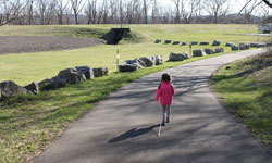
Riverside Trail Guide
The trails near our rivers provide an easy and accessible way to enjoy fresh-air outdoor exercise, fishing, nature photography, scenic views and a commune with nature. Trails range from primitive and hard-packed dirt paths to wide-open paved thoroughfares. Trails are free of costs and can be used for jogging, walking, cycling, pushing baby strollers and walking pets (please clean up after your pets). Most trails are closed at night and shouldn’t be used when it is dark.
Use common sense and follow these trail rules for safe and fund outdoor recreation:
- No motor vehicles, snowmobiles, horses, hunting or firearms.
- Rarely is there winter trail maintenance, usually between November and May.
- Respect private property and stay on the trail.
- Keep pets on a leash and clean up after pets.
- Minimize disturbances of the natural vegetation and wildlife.
- Take all litter home.
- If you see someone vandalizing or misusing a trail or illegally dumping on or along a trail, stream or river, call 911.
White Wagon Nature & Education Trail
Unveiled in the summer of 2023, the White Wagon Nature & Education Trail was constructed by Eagle Scout Jacob Miller. This mile-long trail, located at the White Wagon Boat Launch in Waverly, NY, is an educational walking trail featuring four double-sided trail signs:
- Welcome
- Trail Rules
- About the Chemung River
- Early History
- Native Tribes and Tow Path
- White Wagon Bridge & Local Canal System
- Revolutionary War History: Sullivan-Clinton Campaign
- Wildlife
- Rocks & Fossils
- The Power of Ice
- Prehistoric Tools
Each sign also features information about Boy Scouts of America. We thank Mr. Miller for his hard work on this project, and we thank Town of Chemung, HIlliard Corp., Chemung Valley History Museum, Boy Scouts of America, historian Mary Ellen Kunst, and Studio LMG for their funding, without which this project would not have been possible.
Lackawanna Rail Trail
 This 8.5-mile-long paved trail opened in 2013 and runs between Eldridge Park in Elmira and the Lowman Crossover in the Town of Ashland. The trail sits on the former Erie-Lackawanna Railroad bed. The western half of the trail is elevated over major roads (railroad overpasses) on Elmira’s Eastside and Northside and passes by residential, industrial and business sections of the city.
The trail is great for walking, jogging, cycling, pushing children in baby strollers, cross-country skiing and snowshoeing. The trail is mostly level with a slight decline as you travel east (downstream) and includes features benches and bike racks.
The Eastern section of the trail was home to a former railroad station in Elmira used by the Erie-Lackawanna Railroad that was used by the famed Phoebe Snow, a fancy passenger trail once operated by the Delaware, Lackawanna and Western Railroad (DL&W) and, after a brief hiatus, the Erie Lackawanna Railway. Around 1900, DL&W launched a marketing campaign around the fictional character of Phoebe Snow to emphasize how the exhaust from its steam locomotives was cleaner than competitors' locomotives, as a result of using anthracite coal. The train took its name from the character.
The trail property is owned by the New York State Department of Transportation and occasionally used by New York State Electric & Gas vehicles to access high-tension power lines crossing the trail and river. The City of Elmira maintains the Western section of the trail and Chemung County maintains the Eastern section.
The Eastern section (begins at East Water Street in Elmira) runs along the Chemung River and passes through wooded areas and small meadows with gorgeous views of the river. The Interstate-86 four-lane highway parallels the trail and produces traffic noise.
 There are currently no restroom facilities on the trail, but there may be in the future. The trail includes mile markers painted on the pavement and hung on the fence on the Eastern section of the trail.
Plans include connecting the trail to the Catharine Valley Trail that runs between Seneca Lake in Watkins Glen to the Village of Horseheads, along Route 14.
Parking and Trail Access: Parking is available at Eldridge Park and the Elmira city-owned parking lot on East Water Street (across from Kennedy Valve). There is a tiny parking area for a few vehicles at the western end of the trail, with additional space in a parking lot across Interstate 86.
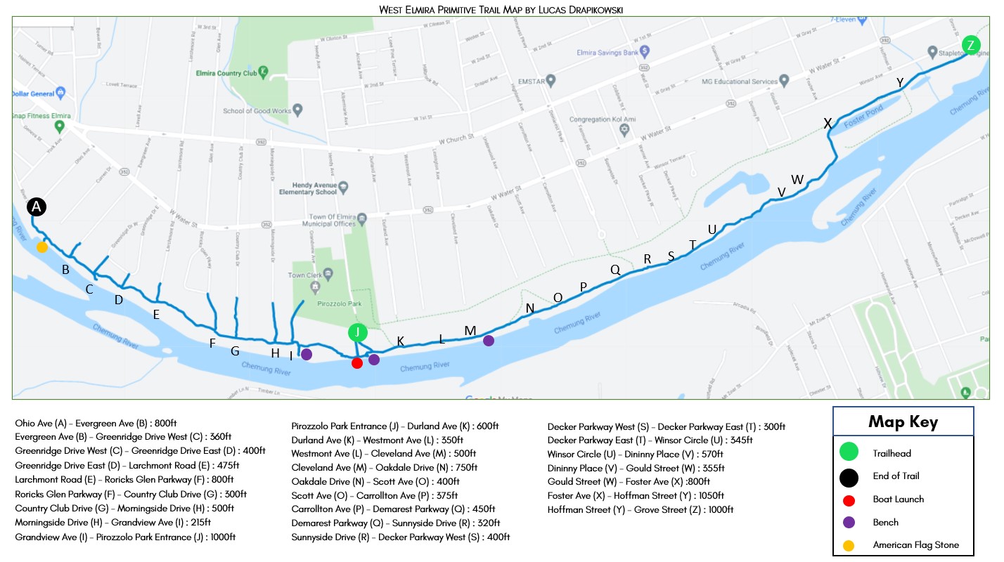
West Elmira Primitive Paths
Download a printable map here.
 These nearly three-mile-long hard-packed dirt paths run through scenic and shaded wooded areas and wide-open meadows. The paths were not constructed but are the result of people walking over them for hundreds of years. The paths were used by Native Americans who settled villages along the river.
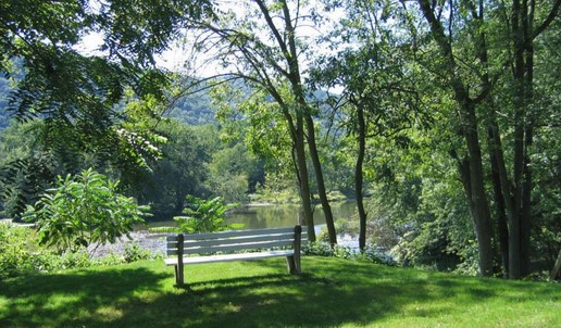
Today, the paths are popular for walking dogs, jogging, hiking, mountain-biking and cross-country skiing. The paths form a series of three parallel trails that follow the Chemung River. They provide spur trail access to beautiful grassy riverbanks and flatlands beneath shady willow trees along the river – great for fishing, nature photography or simply sitting and watching the river flow. The trails feature benches and two bench swings, installed by River Friends, that provide excellent scenic views of the river.
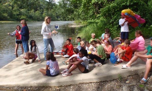
The paths cross hundreds of plots of land owned by the New York State Department of Environmental Conservation (DEC), municipalities and private landowners. The paths go between the Grove Street Boat Launch in Elmira and end near the Fitch’s Bridge Boat Launch in Big Flats.
The trails are narrow, with many knolls, bumps, tree roots and rain washouts. The trails are maintained by DEC, Chemung River Friends, municipalities and trail users.
Parking and Trail Access: Parking is available in a large lot behind the Elmira Town Hall, 1255 W. Water St. and the Grove Street Boat Launch (at the southern end of Grove Street, up and over the grass levee). More than a dozen streets in West Elmira dead-end at the grass flood levee that runs near the trail. There is parking for a few vehicles at each of these dead ends.
 Towanda River Walk
The .9-mile asphalt trail extends from Bradford County Veterans Memorial Park in Towanda, Pa., and runs along Merrill Parkway, before picking up residential sidewalks. This river walk boasts something for everyone -- parks, benches that overlook the Susquehanna River, river boat access points, and easy access to downtown businesses to visit along the way. Because the trail parallels the Susquehanna River, there is little elevation gain/loss, which makes this a perfect trail for families and young children. Walkers and hikers are welcome along the river walk, but there is no biking allowed on the trail. Bikers are encouraged to utilize Merrill Parkway, which runs on the inland side of the trail.
Parking and Trail Access: The Towanda River Walk is an easily accessible trail due to its proximity along Merrill Parkway. There are numerous access points along its .9-mile corridor and easily connect it to Main Street. Parking can be found at Bradford County Veterans Memorial Park, as well as on-street parking along Merrill Parkway.